
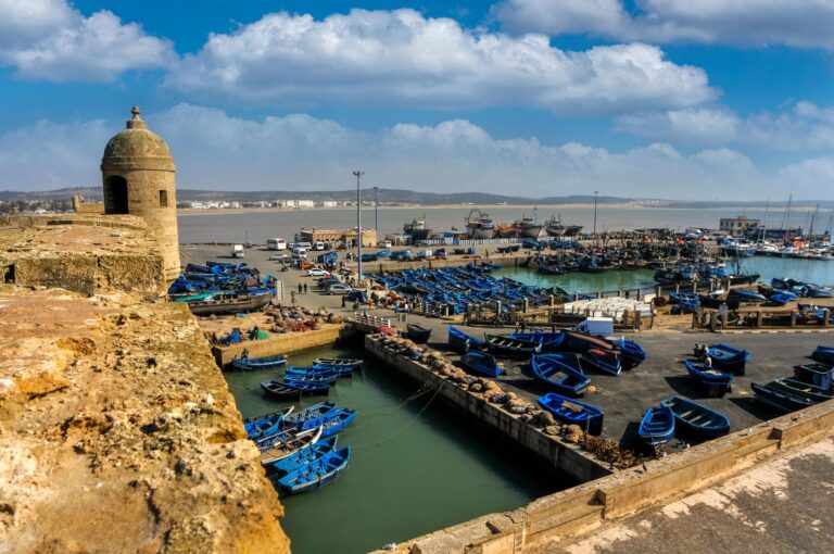
Maps of Morocco: Cities, Regions, Routes & Travel Distances
Planning a trip to Morocco becomes much easier when you understand the country’s geography. Morocco is a fascinating destination where Atlantic and Mediterranean coastlines, historic imperial cities, mountains, valleys, deserts, palm groves, and traditional villages all come together within one country.
A good maps of Morocco can help travelers understand the distances between destinations, choose the right route, and decide how many days they need for their journey. Whether you are planning your first Morocco vacation, a private tour, a family holiday, a desert adventure, or a hiking trip in the Atlas Mountains, understanding the Maps of Morocco is an important first step.
At AFC Morocco Travel, we believe that a well-planned Morocco itinerary should not simply connect famous cities. It should also take into account geography, driving times, landscapes, local experiences, and the pace of travel.
In this guide Maps of Morocco, we explore the different maps of Morocco and explain the country’s main regions, cities, mountain ranges, desert areas, coastlines, and popular travel routes.
Why Do You Need a Map of Morocco?
Morocco may look relatively compact on a world map, but distances can be greater than many first-time visitors expect.
For example, Marrakech and Fes are both major tourist destinations, but traveling between them takes several hours by road. Reaching the Sahara from Marrakech also requires a significant journey through the mountains and southern valleys.
A Maps of Morocco helps you understand:
Where Morocco’s major cities are located
The position of the Atlas Mountains
Where the Sahara Desert begins
The location of the Atlantic and Mediterranean coasts
The distance between Marrakech, Fes, Casablanca, and other major cities
Where popular desert destinations such as Merzouga and Chegaga are located
How to organize a logical touring route
Which regions are best for hiking, culture, beaches, or desert experiences
Instead of looking at Morocco as a list of destinations, a map allows you to see how these places fit together.
Maps of Morocco: An Overview
Morocco is located in North Africa, at the northwestern corner of the continent. It has coastlines along both the Atlantic Ocean and the Mediterranean Sea.
The country’s geographic position has played an important role in its history. Morocco has long been a meeting point between Africa, Europe, the Mediterranean, and the Atlantic world.
The country includes several distinct geographical environments:
Northern Morocco is influenced strongly by the Mediterranean and includes destinations such as Tangier, Tetouan, and Chefchaouen.
Central Morocco includes historic cities such as Fes, Meknes, Rabat, and Marrakech, as well as the Middle and High Atlas mountain ranges.
Southern Morocco is known for dramatic valleys, kasbahs, palm groves, desert landscapes, and destinations such as Ouarzazate, Zagora, Merzouga, and the Sahara.
Western Morocco faces the Atlantic Ocean and includes Casablanca, Essaouira, Agadir, El Jadida, and many coastal communities.
Understanding these broad areas makes it easier to create an itinerary.
Maps of Morocco’s Major Cities
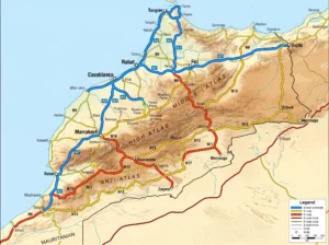
A map showing Morocco’s major cities is one of the most useful maps for travelers.
Some of the country’s most important destinations include:
Casablanca
Casablanca is Morocco’s largest city and an important economic and commercial center. Located on the Atlantic coast, it is often the arrival point for international travelers.
Although many visitors spend only one night in Casablanca, the city can be an interesting introduction to modern Morocco.
Rabat
Rabat is Morocco’s capital and is located north of Casablanca along the Atlantic coast.
The city combines historic sites, coastal scenery, government institutions, gardens, and modern neighborhoods. It is often included in cultural and imperial-city itineraries.
Marrakech
Marrakech is one of Morocco’s most famous tourist destinations.
Located near the foothills of the High Atlas Mountains, Marrakech is an excellent base for exploring the surrounding countryside, mountain valleys, and desert routes.
It is also one of the most common starting points for Morocco desert tours.
Fes
Fes is one of Morocco’s great historic and cultural centers.
Located in northern-central Morocco, Fes is particularly important for travelers interested in history, traditional craftsmanship, architecture, and cultural heritage.
Meknes
Meknes is another historic imperial city and is located close to Fes and the ancient Roman site of Volubilis.
Its location makes it easy to combine with Fes, Chefchaouen, and northern Morocco.
Chefchaouen
Chefchaouen is located in the Rif Mountains in northern Morocco.
The city is famous for its blue-painted streets and mountain setting. On a Morocco map, you can see that Chefchaouen is geographically quite different from Marrakech and the southern desert.
Essaouira
Essaouira is an Atlantic coastal city west of Marrakech.
It is known for its historic medina, fishing port, beaches, seafood, coastal atmosphere, and relaxed character.
A Marrakech–Essaouira route is one of the most popular short journeys in Morocco.
Agadir
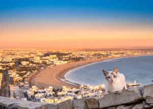
Agadir is located on Morocco’s southern Atlantic coast and is known for its beaches and mild coastal climate.
It can be combined with Taroudant, Essaouira, the Anti-Atlas, and southern Morocco.
Ouarzazate
Ouarzazate is often described as a gateway to southern Morocco.
Its location between the High Atlas and the desert regions makes it an important stop on routes connecting Marrakech with the Dades Valley, Todra Gorges, Merzouga, and Zagora.
Merzouga
Merzouga is located in southeastern Morocco near the Erg Chebbi sand dunes.
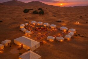
It is one of Morocco’s most famous Sahara destinations and is particularly popular for desert camps, dune experiences, sunrise and sunset landscapes, and desert exploration.
Zagora and Chegaga
Zagora is located in the Draa Valley and is an important gateway to southern desert areas.
Further west and south lies the Chegaga region, known for its extensive dunes and more remote desert atmosphere.
Maps of Morocco’s Mountain Ranges
Morocco is not simply a desert destination. Mountains cover a significant part of the country and create some of its most spectacular landscapes.
The country’s major mountain systems include the Rif Mountains, Middle Atlas, High Atlas, and Anti-Atlas.
The Rif Mountains
The Rif Mountains stretch across northern Morocco.
They are particularly important when visiting Chefchaouen and surrounding northern areas.
The landscapes are greener and more mountainous than the desert regions farther south.
The Middle Atlas
The Middle Atlas is located in central Morocco.
It includes forests, mountain villages, lakes, valleys, and highland landscapes.
Destinations around Ifrane and Azrou provide travelers with a completely different experience from the cities and desert.
The High Atlas
The High Atlas is one of the most important geographical features for travelers.
The mountain range extends across central Morocco and includes some of the country’s highest peaks.
The High Atlas separates Marrakech and the central plains from many of the southern valleys and desert regions.
The famous Tizi n’Tichka mountain pass connects Marrakech with Ouarzazate by road.
For travelers interested in hiking, the High Atlas offers numerous possibilities, including village walks, multi-day treks, and mountain adventures around Imlil and Azzaden Valley.
The Anti-Atlas
The Anti-Atlas is located farther south.
This region offers dramatic rocky landscapes, valleys, oases, and traditional communities. It is less visited than Marrakech, Fes, or Merzouga, making it particularly attractive for travelers looking for a quieter journey.
Maps of Morocco’s Desert Regions
One of the most common misconceptions about Morocco is that the entire country is desert.
In reality, the Sahara occupies only part of Morocco.
The desert regions are primarily found in the southeast and south, while northern and coastal areas can look completely different.
Two major Sahara destinations for travelers are Erg Chebbi near Merzouga and Erg Chegaga near M’Hamid.
Erg Chebbi
Erg Chebbi is the better-known desert destination for many first-time visitors.
The dunes are located near Merzouga and are often included in routes from Fes or Marrakech.
Travelers can experience desert camps, dune landscapes, sunrise and sunset, and local desert communities.
Erg Chegaga
Erg Chegaga is a more remote desert region.
It is located farther from major urban centers and generally requires a 4×4 transfer from the M’Hamid area.
For travelers who want a more remote desert experience, Chegaga can be an excellent choice.
The route can also include the Draa Valley, desert landscapes, nomadic encounters, and areas around Lake Iriki.
Maps of Morocco’s Atlantic Coast
Morocco’s Atlantic coastline stretches for a considerable distance and includes some of the country’s most popular coastal destinations.
Important coastal cities and towns include in Maps of Morocco:
Tangier
Rabat
Casablanca
El Jadida
Essaouira
Agadir
Taghazout
Each destination has its own character.
Casablanca is a major urban center, while Essaouira offers a more relaxed historic coastal atmosphere. Agadir is known for its beaches and resorts, while Taghazout is particularly popular with surfers.
For travelers with more time, a coastal itinerary can provide an excellent alternative to the traditional imperial-city and Sahara routes.
Maps of Morocco’s Mediterranean Coast
Northern Morocco also has a Mediterranean coastline.
Tangier is strategically located near the Strait of Gibraltar, making it an important gateway between Morocco and Europe.
Other northern destinations include Tetouan, Al Hoceima, and coastal communities along the Mediterranean.
This part of Morocco can be particularly interesting for travelers who want to combine beaches, mountains, historic towns, and northern culture.
Maps of Morocco’s Famous Travel Routes
A Morocco travel map becomes particularly useful when planning road trips.
Here are some popular routes.
Marrakech – Ait Benhaddou – Ouarzazate
This route crosses the High Atlas Mountains and is one of the most scenic journeys in Morocco.
Travelers can visit mountain landscapes, traditional villages, Ait Benhaddou, and Ouarzazate.
Ouarzazate – Dades Valley – Todra Gorges
This route takes travelers deeper into southern Morocco.
The landscape changes from dry mountain scenery to valleys, kasbahs, palm groves, and dramatic gorges.
Todra Gorges – Erfoud – Merzouga
Continuing east brings travelers toward the Sahara.
Erfoud is associated with the desert region, while Merzouga provides access to Erg Chebbi.
Merzouga – Draa Valley – Ouarzazate
Traveling west from the Sahara brings you through the Draa Valley and other southern landscapes before reaching Ouarzazate.
Marrakech – Essaouira
This is one of the easiest coastal escapes from Marrakech.
It is an excellent option for travelers who want to combine an inland city with an Atlantic coastal experience.
Fes – Merzouga – Marrakech
This is one of the classic Morocco touring routes.
Travelers can combine Fes, the Middle Atlas, desert landscapes, the Dades Valley, the High Atlas, and Marrakech.
Because the journey covers a significant distance, it is best planned over several days rather than rushed.
Maps of Morocco for a 7-Day Trip
If you only have one week, avoid trying to visit the entire country.
A practical itinerary could focus on Marrakech and southern Morocco, or Fes and the Sahara.
For example:
Marrakech → High Atlas → Ait Benhaddou → Ouarzazate → Dades Valley → Merzouga → Marrakech
Another option is:
Casablanca → Rabat → Chefchaouen → Fes → Merzouga → Marrakech
The best choice depends on your interests and arrival and departure airports.
Maps of Morocco for a 10-Day Trip
With ten days, you have more flexibility.
A classic itinerary could connect:
Casablanca → Rabat → Chefchaouen → Fes → Merzouga → Dades Valley → Ouarzazate → Marrakech
Another possibility is to focus more strongly on southern Morocco:
Marrakech → Ait Benhaddou → Ouarzazate → Dades → Todra → Merzouga → Draa Valley → Ouarzazate → Marrakech
A good itinerary should balance sightseeing with travel time.
Maps of Morocco for Hiking and Adventure
Travelers interested in hiking should look closely at the mountain regions on a Morocco map.
The High Atlas around Imlil and Azzaden Valley is particularly suitable for mountain experiences.
Depending on fitness level and available time, travelers can choose:
Short village walks
Day hikes
Multi-day mountain treks
High-altitude adventures
Valley walks
Cultural hiking experiences
A map helps you understand how mountain villages are connected and why some hiking routes require more time than a simple city excursion.
How Large Is Morocco?
One reason travelers benefit from looking at a map before booking is that Morocco covers a large geographical area.
The country has considerable variation in landscapes and climate.
You can potentially experience:
Atlantic beaches
Mediterranean coastline
Historic cities
High mountains
Green valleys
Palm oases
Rocky plateaus
Deep gorges
Sand dunes
Desert camps
All of these landscapes exist within the same country, but they are not necessarily close together.
This is why a Morocco tour should be designed around geographical zones rather than simply adding as many destinations as possible.
Google Maps and Morocco Travel Planning
Digital maps are extremely useful when planning a Morocco trip.
Google Maps and other navigation tools can help travelers understand approximate distances and travel times.
However, road travel times in Morocco can vary depending on mountain roads, traffic, weather, stops, road conditions, and the type of vehicle being used.
For this reason, the shortest route on a digital map is not always the best route for a tourism itinerary.
A professional local DMC can help transform a map into a realistic travel plan.
Why Work With a Local Morocco DMC?
A map tells you where a destination is. It does not always tell you how long you should stay there, which road is most scenic, where to stop for lunch, which local experiences are worthwhile, or how to organize the route efficiently.
This is where local knowledge becomes valuable.
At AFC Morocco Travel, we design private and customized Morocco journeys based on travelers’ interests, available time, preferred pace, accommodation level, and travel style.
Our local operations allow us to coordinate transportation, accommodation, guides, activities, desert experiences, hiking, cultural visits, and other travel logistics across Morocco.
For travel agencies and tour operators, working with a local DMC can also simplify logistics and provide professional support on the ground.
Final Thoughts: Let the Map Guide Your Morocco Adventure
A maps of Morocco is more than a geographical reference. It is the starting point for understanding how diverse the country really is.
The distance between Marrakech and the Sahara, the location of the High Atlas, the relationship between Fes and Chefchaouen, and the position of Essaouira along the Atlantic coast all become much clearer when you look at the country as a whole.
Morocco rewards travelers who take the time to plan their route carefully.
Instead of trying to see everything, choose the regions that match your interests. If you love history, focus on the imperial cities and cultural heritage. If you want mountains, explore the High Atlas. If the Sahara is your dream, allow enough time to reach the desert without rushing. If you love the ocean, explore the Atlantic and Mediterranean coasts.
And if you want to combine several of these experiences, a well-designed multi-day itinerary can connect them into one unforgettable journey.
Ready to explore Morocco? AFC Morocco Travel can help you turn the map into a personalized Morocco journey, from the historic cities and Atlas Mountains to the Atlantic coast and Sahara Desert.
Practical Distance and Travel-Time Table
| Route | Approx. Distance | Direct Driving Time | Realistic Travel Time with Stops |
|---|---|---|---|
| Marrakech → Casablanca | 240 km | 2.5–3 hrs | 3–4 hrs |
| Marrakech → Essaouira | 175–190 km | 2.5–3 hrs | 3–4 hrs |
| Marrakech → Agadir | 250–260 km | 3 hrs | 3.5–4.5 hrs |
| Marrakech → Imlil | 65 km | 1–1.5 hrs | 1.5–2 hrs |
| Marrakech → Ouarzazate | 195–200 km | 3.5–4 hrs | 4–5 hrs |
| Marrakech → Dades Valley | ~300 km | 5–6 hrs | 7–9 hrs |
| Marrakech → Merzouga | 550–560 km | 9–10 hrs | 10–13 hrs |
| Fes → Chefchaouen | 195–200 km | 3–3.5 hrs | 4–4.5 hrs |
| Fes → Rabat | ~200 km | 2.5–3 hrs | 3–4 hrs |
| Fes → Merzouga | 460–470 km | 7–8 hrs | 8–10 hrs |
| Casablanca → Rabat | ~90 km | ~1 hr | 1–1.5 hrs |
| Casablanca → Fes | 290–300 km | 3–3.5 hrs | 4 hrs |
| Tangier → Chefchaouen | 105–115 km | ~2 hrs | 2–3 hrs |
| Ouarzazate → Merzouga | 350–360 km | 5–6 hrs | 7–9 hrs |
| Merzouga → Tinghir | ~190 km | ~3 hrs | 3.5–4 hrs |
| Tinghir → Dades Valley | ~50 km | ~1 hr | 1–1.5 hrs |
These figures are useful planning estimates rather than guaranteed journey times. In particular, the High Atlas and Rif roads can make a relatively short distance take considerably longer than a motorway journey.
Morocco Desert Travel: Distances to Merzouga
For travelers specifically interested in the Sahara, this smaller table is particularly useful:
| Starting Point | Approx. Distance to Merzouga | Direct Driving Time | Recommended Approach |
|---|---|---|---|
| Marrakech | 550–560 km | 9–10 hrs | 2–3 days with sightseeing |
| Fes | 460–470 km | 7–8 hrs | 1–2 days depending on stops |
| Casablanca | ~560 km | 8–9+ hrs | Split over several days |
| Rabat | ~530 km | 8–9 hrs | Combine with Fes |
| Ouarzazate | 350–360 km | 5–6 hrs | Full travel day |
| Errachidia | ~120–150 km | 1.5–2.5 hrs | Convenient final approach |
| Erfoud | ~55 km | ~45 min | Easy connection to Merzouga |
| Rissani | ~35 km | ~30 min | Short final leg |
The Marrakech route crosses the High Atlas via the Tizi n’Tichka area before continuing through southern Morocco, while the Fes route travels through Ifrane, Midelt and the Ziz Valley.
How Long Should You Allow for Each Journey?
One of the biggest mistakes when planning a Morocco itinerary is confusing driving time with sightseeing time.
For example, a map might show Marrakech to Merzouga as approximately nine hours of driving. That does not mean travelers should simply leave Marrakech at sunrise and arrive in Merzouga in the evening. The route passes through the High Atlas and southern Morocco, where there are numerous worthwhile stops.
A more comfortable itinerary could look like:
Day 1: Marrakech → Ait Benhaddou → Ouarzazate
Day 2: Ouarzazate → Dades Valley → Todra Gorge → Merzouga
Day 3: Sahara Desert experience → continue toward the next destination
This approach turns a long transfer into part of the Morocco experience. Current route guides similarly recommend breaking the Marrakech–Merzouga journey into multiple days rather than treating it as a simple point-to-point transfer. (Morocco Desert Expeditions)
Short Morocco Routes for Day Trips
Not every Moroccan journey requires an overnight stay. Some destinations work very well as day trips.
| Day Trip | Approx. Distance | Approx. Driving Time Each Way | Recommended? |
|---|---|---|---|
| Marrakech → Imlil | 65 km | 1–1.5 hrs | Yes |
| Marrakech → Essaouira | 175–190 km | 2.5–3 hrs | Yes |
| Marrakech → Ouzoud Falls | ~155 km | 2.5–3 hrs | Yes |
| Agadir → Taroudant | ~80 km | 1–1.5 hrs | Yes |
| Agadir → Tafraoute | ~140 km | ~2.5 hrs | Possible, but long |
| Tangier → Chefchaouen | 105–115 km | ~2 hrs | Yes |
| Fes → Meknes | ~60 km | ~1 hr | Yes |
| Meknes → Volubilis | ~28 km | ~30 min | Yes |
For day trips, it is important to remember that the listed driving time does not include time spent exploring the destination. A three-hour drive each way can easily become a very long day once sightseeing, meals, photographs, and traffic are included. (journey via morocco)
A Useful Rule When Reading a Morocco Map
When looking at distances on a map, use this simple rule:
Short distance + mountain roads = allow extra time.
Long distance + major highway = usually more predictable.
Desert route + sightseeing stops = plan the journey as an experience, not simply a transfer.
This is particularly important when crossing the Atlas Mountains. The distance between Marrakech and Ouarzazate is only around 200 km, but the mountain crossing means travelers should allow approximately four hours or more, depending on conditions and stops. (journey via morocco)
Likewise, Fes to Merzouga is roughly 460–470 km, but the route through the Middle Atlas and Ziz Valley is best enjoyed with stops rather than treated as an uninterrupted drive.
Tip for travelers: When building a Morocco itinerary, don’t simply count kilometers. Count driving hours + sightseeing stops + meals + photo stops + road conditions. This produces a much more realistic schedule and leaves enough time to actually enjoy each destination.